Snowdon hiking routes guide
What is the easiest route up Snowdon?
The Llanberis Path is generally considered the easiest of the six main routes, following a gentle gradient alongside the Snowdon Mountain Railway for around 9 miles return, though "easiest" on Snowdon still means a full day's mountain walk over uneven, exposed terrain with genuine weather risk near the summit.
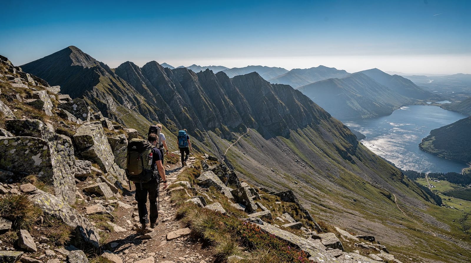
Six paths, one mountain, very different days out
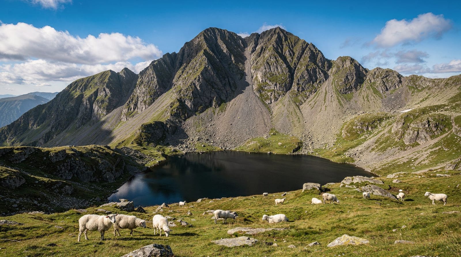
Snowdon (Yr Wyddfa in Welsh), at 1,085 metres, is the highest peak in Wales and one of the busiest mountains in Britain, with an estimated half a million or more ascents a year across its six recognised paths. That popularity is both a comfort and a warning: well-trodden paths mean you’re rarely alone if something goes wrong, but it also means underprepared walkers attempt the mountain in trainers and t-shirts on days when the summit is shrouded in freezing cloud, and North Wales mountain rescue teams deal with the consequences regularly. Choosing the right route for your fitness and experience, and respecting the weather, matters more here than on most UK hills people casually decide to “do.”
What the name Yr Wyddfa actually means
The Welsh name for the mountain, Yr Wyddfa, is generally translated as “the tumulus” or “the burial mound,” tied to a legend that a giant named Rhita Gawr is buried beneath the summit cairn after being defeated by King Arthur — one of several Arthurian legends attached to Snowdonia, a region genuinely rich in this kind of folklore layered over a landscape shaped far more prosaically by Ice Age glaciation. In recent years, Yr Wyddfa has increasingly become the preferred name used in official signage and by the national park authority itself, alongside the English “Snowdon,” reflecting a broader shift toward using Welsh place names as the primary rather than secondary identifier across Eryri (Snowdonia) National Park. Both names are in common use and understood interchangeably by locals and visitors alike.
Llanberis Path — the easiest, and the busiest
Starting from Llanberis and running roughly parallel to the Snowdon Mountain Railway for most of its length, this is the gentlest gradient of the six routes at around 9 miles return, and the one most commonly recommended for first-time Snowdon walkers. It’s also the busiest, partly because it’s the easiest and partly because walkers descending after a railway trip up sometimes choose to walk down this way. The lower stretches are broad and clear; the final push to the summit narrows and steepens, joining the other paths near the top where all routes converge on the same final scramble.
Pyg Track and Miners Track — from Pen-y-Pass
These two routes share the same trailhead at Pen-y-Pass, a high mountain pass reached by road from Llanberis or Capel Curig, and both run around 7-8 miles return. The Pyg Track climbs more directly and steeply from the start, offering dramatic views over Llyn Llydaw almost immediately, while the Miners Track takes a gentler opening section past the lake and old copper mine workings before joining the Pyg Track for the final steep climb to the summit ridge. Pen-y-Pass car park requires advance booking and fills early on any clear-forecast day — arrive without a booking and you’ll likely need the Sherpa’r Wyddfa park-and-ride bus service from Nant Peris or Llanberis instead.
Snowdon Ranger Path — quiet and steady
Starting from Llyn Cwellyn on the western side of the mountain, near the Welsh Highland Railway’s Snowdon Ranger halt, this route is considered by many experienced hillwalkers to be the second-easiest after the Llanberis Path, with a steady, consistent gradient over around 8 miles return. It’s significantly quieter than the Llanberis, Pyg, and Miners routes, making it a good choice for walkers who want the mountain without the crowds.
Rhyd Ddu Path — quiet, varied, slightly technical
Starting near the Rhyd Ddu station on the Welsh Highland Railway, this route at around 7.5 miles return is one of the quietest and, in the view of many regular Snowdon walkers, one of the most scenically varied, crossing open moorland before a narrower ridge section near the top that requires more careful footing than the Llanberis or Snowdon Ranger paths.
Watkin Path — the toughest, and the most dramatic
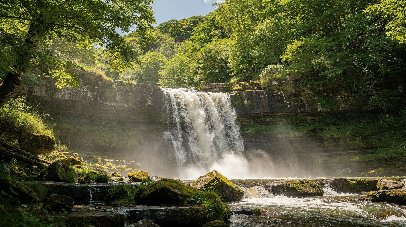
Starting from Nantgwynant on the mountain’s southern side, the Watkin Path is widely considered the hardest of the six routes, with the steepest and most sustained ascent, particularly in its final scramble section. It passes waterfalls and the ruins of a former quarry cottage on its lower reaches, and it’s the route associated with Prime Minister William Gladstone’s opening ceremony speech in 1892 — a slice of Victorian history most walkers pass without noticing. At around 8 miles return, distance alone understates its difficulty; the height gain and terrain make it a serious undertaking best reserved for experienced hillwalkers.
A detailed packing list
Beyond the basics of boots, waterproofs, and layers already mentioned, a few specifics matter more than casual walkers expect. A map (paper, ideally, since phone battery and signal both fail on the mountain) or a downloaded offline GPS route removes reliance on the well-trodden path remaining visible in low cloud, when it’s genuinely easy to lose the trail even on the busier routes. A head torch is worth carrying even for a daytime summer hike, in case a slower-than-expected pace pushes your descent into dusk.
At least a litre and a half of water per person, more in warm weather, since there are no reliable refill points on most routes once you’re above the lower slopes. A basic first aid kit, some high-energy food beyond a single sandwich, and a fully charged phone (even with unreliable signal, emergency services can sometimes triangulate a location from a dead or weak signal in a genuine emergency) round out a sensible list. None of this is excessive for what is, regardless of its accessibility by train on one route, a genuine mountain environment.
Mountain rescue: the numbers behind the warnings
North Wales’s volunteer mountain rescue teams — including Llanberis Mountain Rescue Team and Ogwen Valley Mountain Rescue Organisation, both entirely volunteer-run and reliant on donations — respond to several hundred callouts a year across Snowdonia, a meaningful share of them on Snowdon itself given its popularity.
Common causes include underprepared walkers caught out by sudden weather changes, slips on wet rock (particularly on the exposed final scramble sections near the summit shared by all six routes), and walkers who simply run out of daylight or energy partway through a route they underestimated. None of this is intended to discourage a Snowdon hike — hundreds of thousands of people summit safely and enjoyably each year — but it’s a useful corrective to any assumption that because the mountain is so accessible and well-signposted, it can be treated more casually than a genuine wilderness environment.
Booking a guided hike instead of going solo
If you’d rather not navigate route choice, weather judgment, and parking logistics alone, a guided hike removes most of the planning burden. The Mount Snowdon summit hike from Caernarfon and the guided Snowdon sunrise hike both include a qualified mountain guide, which matters given how many rescue callouts each year involve walkers who underestimated the mountain, misjudged the weather, or lost the path in low cloud. A sunrise hike in particular avoids the worst of the daytime crowds on the busier routes and rewards an early start with genuinely spectacular light over the Snowdonia peaks.
Route difficulty side by side
Ranking the six routes purely by physical demand: the Llanberis Path and Snowdon Ranger Path sit at the easier end, with steady, well-graded gradients and clear, well-maintained paths throughout. The Pyg Track and Rhyd Ddu Path occupy a middle ground, steeper in sections and requiring more careful footing near the summit ridge, but manageable for reasonably fit walkers with proper preparation.
The Miners Track, despite a gentle opening section past the lakes, joins the steep final stretch shared with the Pyg Track, so its overall difficulty ends up closer to the middle-tier routes than its easy start suggests. The Watkin Path stands clearly apart as the most demanding, with the steepest sustained ascent and the roughest underfoot conditions of the standard six routes, before even considering the genuinely technical Crib Goch scramble that sits outside this ranking entirely as a route for experienced scramblers only.
Combining a hike with Llanberis and Llyn Padarn
If your itinerary includes a rest day or a lighter activity to follow a big hike, Llanberis itself offers gentler options at lakeside level: the guided kayak adventure on Llyn Padarn is a good way to enjoy the same mountain scenery from the water rather than on foot, useful the day after a demanding summit walk.
Toilets, facilities, and refreshments along the way
None of the six routes offer facilities along the trail itself beyond the trailheads, so use the toilets at Pen-y-Pass, Llanberis, or wherever your specific route begins before setting off. The summit itself has toilets and a café at Hafod Eryri, the visitor centre also served by the Snowdon Mountain Railway, open through the main operating season roughly March to October — outside this window, or if the railway itself has closed for the day, don’t rely on the summit café being open. Prices at the summit café run a modest premium over valley prices, reasonable given everything has to be brought up by train, and it’s a welcome stop for tea or a hot drink after a long ascent regardless.
Best season to hike
Late spring through early autumn (May to September) offers the most reliable combination of daylight hours, reasonable temperatures, and lower (though never zero) chance of severe weather. July and August bring the busiest crowds on the popular routes, alongside the fullest car parks and the highest demand for Pen-y-Pass bookings. Early autumn (September) often provides a good balance of decent weather and thinning crowds after the school summer holidays end. Winter hiking on Snowdon is a genuinely different undertaking, requiring proper mountaineering equipment (ice axe, crampons) and winter hillwalking experience, and should not be attempted by inexperienced walkers regardless of how manageable the mountain looks from photographs taken in summer conditions.
Weather: the single biggest factor
Snowdon’s summit weather can differ dramatically from conditions at any trailhead — expect it to be 10-15°C colder, considerably windier, and frequently in cloud even when the valleys below are clear and sunny. Check a dedicated mountain forecast (not just a general weather app showing conditions for the nearest town) before setting out, and be genuinely willing to turn back if conditions deteriorate. This isn’t overcaution: a clear, warm day in Llanberis says almost nothing reliable about what you’ll find at 1,085 metres.
Getting there from Chester
Snowdon’s various trailheads are roughly 1 hour to 1 hour 30 minutes’ drive from Chester via the A55 and A5, depending on which route you’re starting. There’s no direct rail access to most trailheads; the closest rail-adjacent starting points are Rhyd Ddu and Snowdon Ranger, both served by the Welsh Highland Railway. For most visitors, driving or joining an organised tour from Chester is the practical option — see our Snowdonia adventure itinerary for a two-day plan that pairs a Snowdon hike with lower-key activities, and our wider North Wales adventure activities guide for how a Snowdon hike fits alongside Zip World, watersports, and the region’s waterfalls.
Combining routes: the classic “horseshoe” style circuits
Experienced walkers sometimes combine two routes into a single circular walk rather than retracing the same path both ways — ascending via the Pyg Track and descending via the Miners Track (or vice versa) is a popular combination, since both share the Pen-y-Pass trailhead and together offer more varied scenery than an out-and-back on a single route. The more serious Snowdon Horseshoe, linking Crib Goch’s exposed, knife-edge ridge with the Pyg Track and Miners Track, is a genuinely challenging scramble requiring a head for heights, sure footing, and ideally some scrambling experience or a qualified guide — it is not a route for casual walkers or families, and every year sees incidents involving people who underestimated Crib Goch’s exposure after seeing photographs online without appreciating the scale of the drop either side of the ridge.
Alternatives if hiking isn’t for you
If reaching the summit matters more than the walking itself, the Snowdon Mountain Railway from Llanberis gets you there without a step, weather permitting. For a lower-stakes outdoor day with similarly good views over the coast rather than the high mountains, Great Orme in Llandudno offers walking, a tramway, and cable cars at a fraction of the physical demand.
Common mistakes to avoid
The most frequent and consequential mistake is trusting a general weather app showing conditions for Llanberis or Caernarfon rather than a dedicated mountain forecast for Snowdon’s summit specifically — the two can differ dramatically, and relying on the wrong one has caught out many walkers who set off in shorts on what looked, from the valley, like a warm, clear day. A second common error is underestimating descent time; walkers often plan carefully for the ascent but assume the way down will be quick, when tired legs on steep, loose ground can make the descent nearly as slow as the climb, particularly on routes like the Watkin Path. Finally, many first-time visitors don’t realise Pen-y-Pass car park requires advance booking, arriving to find it full and having to backtrack to Nant Peris or Llanberis for the park-and-ride bus, losing valuable daylight in the process.
Honest verdict
Snowdon deserves its reputation as one of Britain’s best accessible mountain days out, precisely because it offers a genuine range from the gentle Llanberis Path to the serious Watkin Path and Crib Goch scramble, all converging on the same dramatic summit. Respect the mountain rather than the marketing around its accessibility, check the specific forecast for altitude rather than the valley floor, book Pen-y-Pass parking if that’s your chosen trailhead, and choose the route that honestly matches your fitness and experience rather than the one that photographs best — and it remains one of the most rewarding single days achievable from a Chester base.
Frequently asked questions about Snowdon hiking routes guide
How long does it take to hike Snowdon?
Most routes take between 5 and 7 hours round trip for a reasonably fit walker, including rest stops, though this varies by path and conditions. The Llanberis Path and Snowdon Ranger Path are generally the quickest for a steady pace; the Watkin Path and Rhyd Ddu Path can take longer due to steeper, rougher sections.Do I need to book Pen-y-Pass parking in advance?
Yes. The Pen-y-Pass car park, the trailhead for the Pyg Track and Miners Track, requires advance online booking and fills up, especially on weekends and school holidays. If you don't book, use the Sherpa'r Wyddfa park-and-ride bus from Nant Peris or Llanberis instead of hoping for a space.Is Snowdon dangerous?
It's a serious mountain that gets treated too casually by some visitors because of how accessible it looks from the road. Weather at the summit can change rapidly and differ drastically from conditions at the trailhead, and North Wales mountain rescue teams respond to preventable incidents every year involving underprepared walkers in trainers or without proper layers. Respect it like the mountain it is.Can beginners hike Snowdon?
Reasonably fit beginners with proper footwear, weatherproof layers, food, water, and a realistic pace can manage the Llanberis Path or Miners Track in good summer weather. It is not a casual stroll, and beginners should check the forecast carefully, start early, and be willing to turn back if conditions deteriorate.What should I pack for Snowdon?
Proper walking boots (not trainers), waterproof jacket and trousers regardless of the forecast at the base, warm layers since the summit is routinely colder and windier than Llanberis, a map or offline GPS, at least a litre of water, food, and a fully charged phone. Conditions at 1,085 metres in Wales change fast, even in July.
Top experiences
Bookable activities with verified prices and instant confirmation on GetYourGuide.